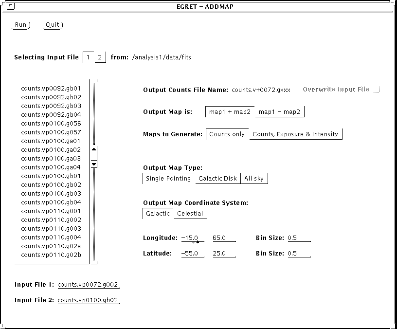
The program lists all the counts files from the FITS_DIR directory and lets the user select the first and second input file to be added simply by clicking on items in the scrollable list. The 1/2 button determines which input file is being selected. The user may also manually enter the file names in the 2 bottom fields for example to select files that are not on the list. The window shows the name of the output file (same as the first input file except for the '+' sign). If the name of the output file is identical to the first input file, the user will be able to have it overwrite the input file (useful when adding many maps into the same map).
The user selects the type of operation on the maps (+ or -). If the 2 input exposure maps exist, the user may select to generate all the output maps or just the counts map. The map type, coordinate system and sky region must also be specified. Note that these are set by default to the values of the first input map. The map parameter options also change depending on the first input map according to what the program allows. For example, if the first input map is in sun centered coordinates, that will be the only allowed coordinate system and the second map will have to be in the same system.