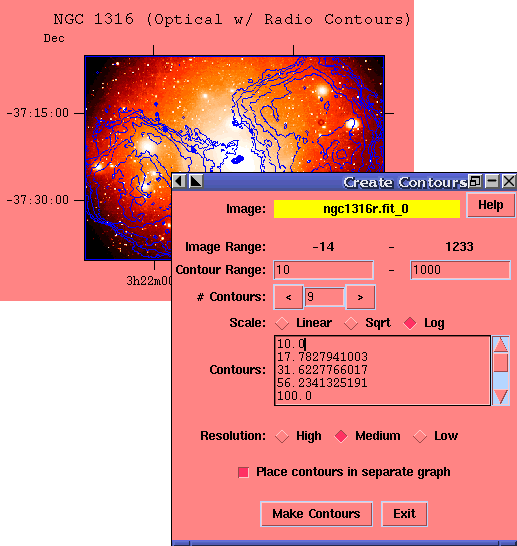
POW Contours and RegionsPOW can create contour maps of images and read/write/create standard SAO regions files. Contours:The image below shows a set of contours overlain on top of an image. The blue contours were made from a separate radio map image and then moved to this graph containing an optical image of the same object. The dialog box shows the options available for creating contours.
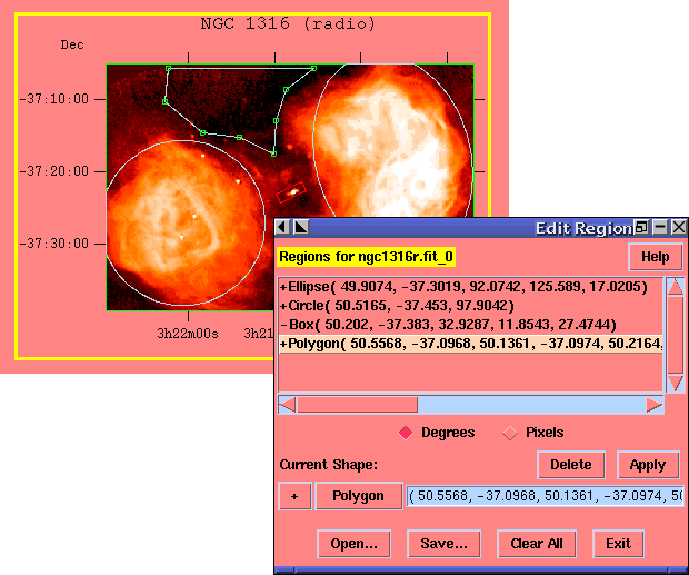
Regions:Region shapes supported are circle, ellipse, box, polygon, point, and line. Shapes can be inclusive ('+' shapes drawn in grey) or exclusive ('-' shapes drawn in red). All shapes can be moved and reshaped with the mouse by dragging the green handles drawn on the current shape.
Pages maintained by Bryan Irby Send bug reports or feature requests to ftoolshelp@athena.gsfc.nasa.gov |